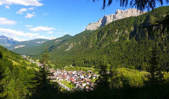
Hiking in the Unesco Dolomites
The village may be small, but it has a lot to offer. The valley floor may have places with refined details and cosy corners, but if you venture just above the woods, vast horizons open up which are a feast for the eyes and lift your heart and spirit.
Once you have parked your car at your accommodation or in one of the two public car parks in Sottoguda, the stress of your everyday life begins to fade away: take a breath of pure mountain air, listen to the babbling stream and you will begin to feel free.
Sottoguda is the ideal destination for anyone who loves leaving their car behind and hiking in the unspoiled landscape of the UNESCO Dolomites. Below are a number of suggested itineraries, all starting in the village, which will provide unforgettable moments of calm and inner peace, so you can reconnect with your true self or just enjoy a walk with your nearest and dearest.
Ask for a detailed map where you are staying or at the Tourist Office.
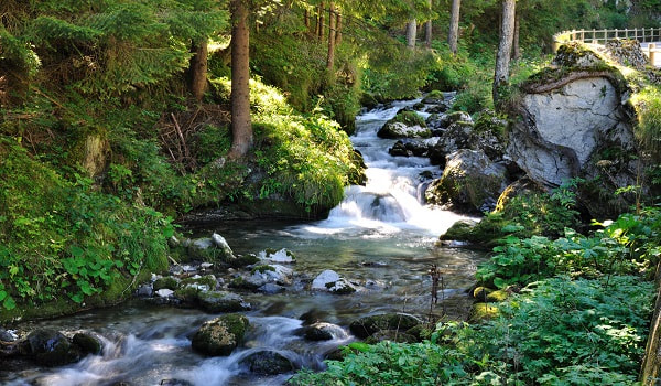
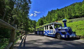
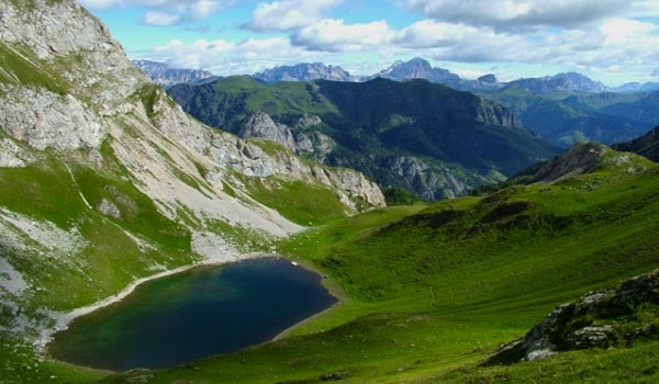
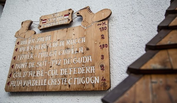
1- Serrai di Sottoguda canyonTime: 40 minutes Ascent: 200 metres Suitable for pushchairs The Serrai di Sottoguda Natural Park is a magical, fairy-tale place that will leave you feeling totally regenerated. This 2.5 km-walk transports you into a truly mystical atmosphere where you will experience the gentle babbling of the stream and waterfalls, the church of Sènt Antòne, the balsamic scent of the larch trees and the centuries-old firs which cling to the vertical rock faces and the pure mountain air. This lovely cool place offers relief from the heat in the summer. The canyon is served by a small train which runs from Sottoguda to Malga Ciapéla, ideal for children or people with reduced mobility who do not want to miss out on this wonder. Bikes are also welcome in the Serrai, following the route from Sottoguda to Malga Ciapéla. Following the exceptional weather events of October 2018, the access to the gorge is wating to be restored. From Malga Ciapéla, a 15-minute cableway ride will take you to the top of the Marmolada where you can visit the new Great War Museum at the intermediary station of Seràuta, near the Monumental Area. Entrance is included in the price of the ticket. Malga Ciapéla is also the starting point for the famous climb of the majestic south face of the Marmolada. Malga Ombretta is located in the bucolic pastures of Val Ombretta (60 mins from Rù Dalbèrch, past the camp site), the geographical centre of the UNESCO Dolomites and home to the rare albino marmot. The Faliér refuge (40 mins) and the Ombretta Pass (1 hr 30 mins) are both within easy reach. |
|
2- Col dele OteTime: 30 minutes
Ascent: 150 meters Take the scenic path from the bridge in La Vèrda (at the Serrai ticket office) and, after a couple of bends, you will be able to look down on the village of Sottoguda and Val Pettorina, with a wide-reaching view over the surrounding mountains. At the Rù de Rùzaton bridge, look out for the lovely Sgrìnfe de l Diàul, rare rampions set in the rocks. From Col dele Ote, you can take the flat route to Malga Ciapéla (30 mins) or go to the ancient farmhouses in Sofedéra (45 mins). |
|
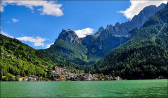
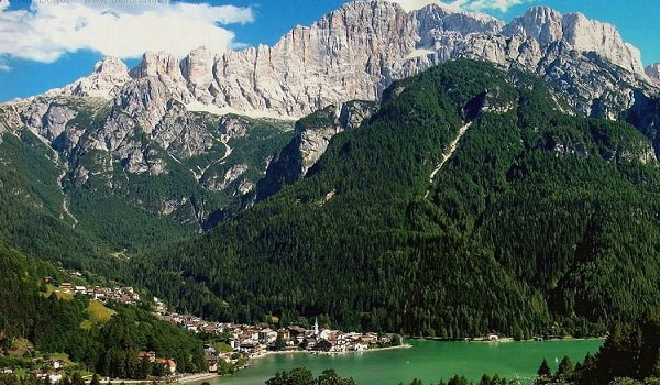
3- Alleghe lake
|
Time: 2 hours
Ascent: 250 metri, gran pa Go past the Sol&Nef Apartments on the right of the river, then start a reinvigorating walk along the edge of the woods, past the lovely Pian da Le Risće picnic area to the hamlets of Sorarù and Savinèr di Laste. The route then follows the Cordévole river from Caprile to the famous lake in Alleghe which reflects the majestic north-west face of Civetta. You can rent rowing boats, pedalos and kayaks at the lake and practise catch and release sportfishing. |
|
4- ValbonaTime: 60 minutes to the Malga Valbona
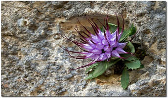
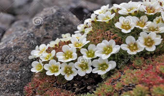
Ascent: 500 metres Hiking in the remote Valbona wilderness is cool in the summer and you are surrounded by volcanic rocks where precious examples of protected Alpine flora are hidden in the cracks. The names of a number of local places are a reminder of the ancient quarries where the finest basalt was extracted to build the cornerstones of local houses. One such place is I Ciantógn di Buoji, which lies at the entrance to the cool, lush Valbona, on the right of the river. When you reach the old Malga di Valbona (60 mins), you can either continue on to Forcella di Valbona (1 hr 45 mins) or Forcella delle Fontane (1 hr 45 mins) and go over the crest into Val del Biois. An important feature of this area is the native flora, typical of artic areas and a legacy of past Alpine glaciations. |
|
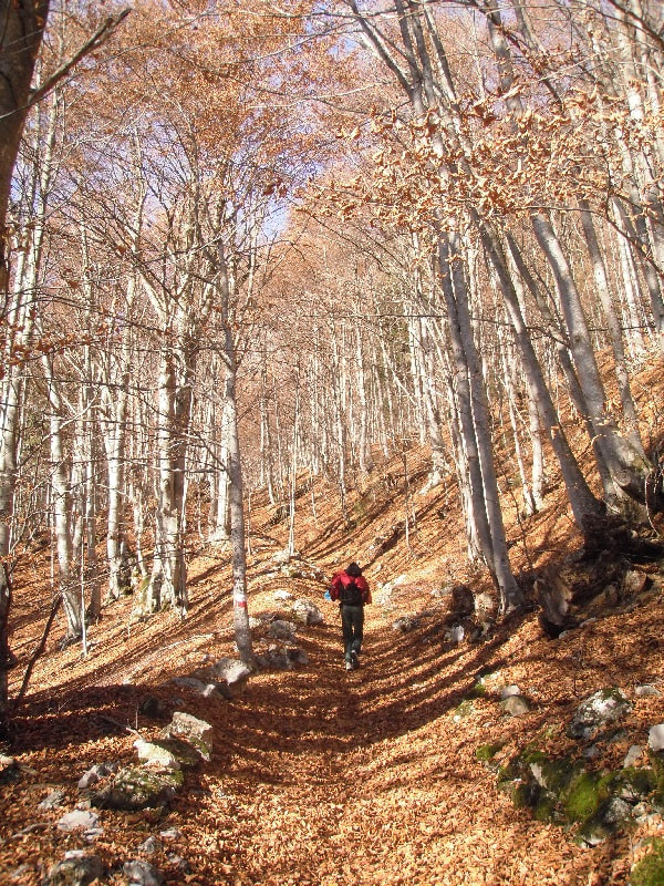
5- Bosch di Faièr and the old village of SofedèraTime: circular route approx. 2 hours
Ascent: 300 metres Start at the playground in Sottoguda and cross the Pettorina stream. After going through La Céva, a village lying by the remains of the ancient farmhouse of Sottoguda, you will enter a spectacular wood of beech trees: I Faièr. Follow the directions to the sunny hamlets of Albe and Valier which together make up the old village of Sofedèra, inhabited until the Sixties. Here are some outstanding examples of stone houses. Of particular interest is the Ciesa di Lece, where the workmanship of the stone cutting is of the highest standards. Stop and have a chat with Umberto! He’s the only one who lives in the village today and he lovingly keeps it in order. He will show you some of the many elements he is trying to preserve. On the way back, complete the circular tour with a quick stop off at the hamlet of Le Palue with its pretty tabièi (hay barns), before returning to Sottoguda. |
|
6- Franzéi and Lèch di Giai
|
Time: 60 minutes until Franzéi
Ascent: 1100 metres Once you have gone past the last house in Sottoguda, the Ciesa La Vèrda in the direction of Serrai, turn immediately left and walk up the mule track until you reach the main road of the Fedaia Pass. Cross it and continue along the road through the woods and meadows which offers different views along the way (the plain of I Piegn with its fir trees which are hundreds of years old) until you reach the beautiful Franzéi valley, where you can often come across good natured cows and horses (50 mins). Go back up the Val de la Miniera, home to the ibex, and you will come to a lovely glacial basin with a lake whose waters are a deep cobalt blue: it is Lèch di Giai where, according to legend, the Eivàne, mythological Ladin creatures, used to come to bathe (60 mins from Franzéi). From here you can reach Forcella dei Giai (20 mins) or the more challenging Cima dell’Auta (60 mins for experienced hikers). |
|
7- Col de Fedèra and the ridges of Migogn
|
Time: 1 hr 40 minutes to Col de Fedèra, 3 hr 30 minutes to the top of I Migogn
Ascent: 750 metres to Col de Fedèra, 1150 to the top of I Migogn When you come out of Bosch di Faièr, like in walk no. 6, you get to Mont de Sot (60 mins from Sottoguda, quite a tiring walk), where you can drink from a refreshing fountain. Just before there, stop for a rest on a stone seat used by farmers for centuries and admire the ancient larch trees in the village of Cosproè. From Col dal Tón on Mont de Sot, follow the directions for Col d'Albe (25 mins) where you will reach the ledge of Col de Fedèra (15 mins), once a busy haymaking centre, as you can imagine from the many tabièi (hay barns) there. In summer many people from Sottoguda literally migrated to the highlands to get hay which was carried down the valley on large luoze (sleds). The Stagudèr, who transported food, farmyard animals, essential goods and their children in zarlìn (baskets), were good-naturedly nicknamed beduini (Bedouins). Next climb the steep grassy slopes of Mont de Sora to the ridge of I Migogn, where you will have a 360° view from the edge of an ancient volcano. Nearby, on Zime de Agnereze, you can see the remains of the medium-calibre batteries which were aimed at the Cherz plateau (Campolongo Pass) in the First World War. A spotlight was placed on the top which lit up Col di Lana. |
|
8- Piz de GudaTime: 2hr 45 minutes
Ascent: 900 metri Seen from down below, the huge Piz de Guda looks like a kind of Machu Picchu in miniature. The name Sottoguda means “the places that lies below Piz Guda”. When you come out of Bosch di Faièr, like in walks 6 and 7, you will reach Mont de Sot (60 mins from Sottoguda, quite a tiring walk). Continue to Col dal Tón and turn left for Piz de Guda. Walk along the slopes of I Arjèi until you meet a stream which you follow upwards for 150 metres. Cross it, you will see the remains of an ancient aiél (charcoal kiln), uncovered by deer which paw the ground in the mating season as they battle it out for partners. Walk to the Forcia pass then follow the final stretch towards Piz de Guda, littered with remains from the military trenches during the Great War, until you reach the top of Piz de Guda. |
|
Worth visiting
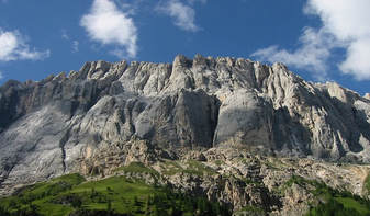
Marmolada - The Queen of the Dolomites
and the highest museum in Europe |
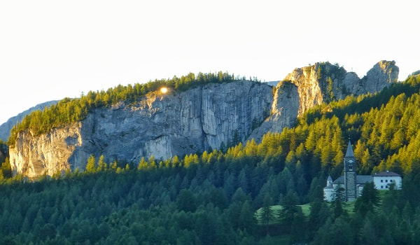
Village of Laste and Sas de Ròcia
|
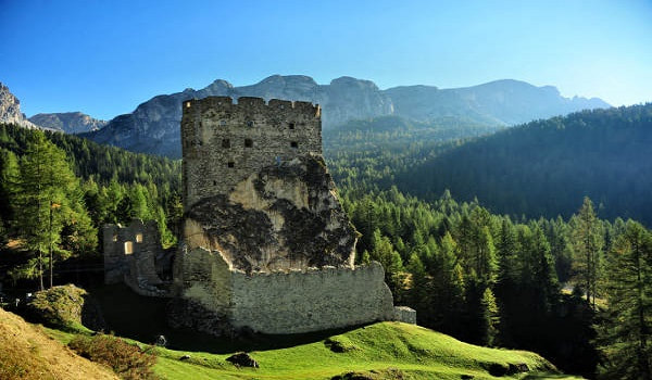
Andràz castle
|
|
|
|
|
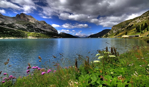
Alleghe lake
and Civetta north-west face |
Marmolada glacier
and Fedaia lake |
Mondevàl's prehistoric man
and Museum Vittorino Cazzeta |